Colorado is the rectangle shaped
state in the western United States. The Rocky Mountains, form the
most dominant physical feature of the state. To the west of the
Rockies lie the high plateaus of the Colorado Plateau, and to the
east are the Great Plains. High, rugged mountains and plateaus occupy
fully two-thirds of the state, and make Colorado a state of striking
beauty. All of Colorado is more than 3300 feet above sea level. The
state, with an average elevation of about 6800 feet, is the highest
of all the states.
The mountains and plateaus are rich in gold, silver, and other minerals and are the source of most of the state's water. The mountains have played a major role in the development of Colorado, most recently by attracting a steady flow of tourists, but they have also been a barrier to travel, communication, and settlement. Except for small cities and towns in the sheltered river valleys and mountain basins, most of western Colorado is sparsely populated.
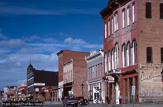
In contrast, eastern Colorado has flat, treeless plains that extend from the Rockies to the Nebraska and Kansas state lines. Cultivated where there is sufficient moisture or irrigation, they consist of croplands and grasslands. On the plains just east of the Rockies is Denver, which is the state capital, the center of the state's largest metropolitan area, and a major city of the Western United States.
The state's name, Colorado, is a Spanish word meaning "reddish colored." It was the name early Spanish explorers gave to the Colorado River, which originates in the state. When Colorado became a territory in 1861, William Gilpin, the first territorial governor, formally requested that it be called by the old Spanish name. Colorado was admitted to statehood on August 1, 1876, during the 100th anniversary of the signing of the Declaration of Independence, and today its official nickname is the Centennial State.
 Famous
for its portion of the Rocky Mountains, the state of Colorado has
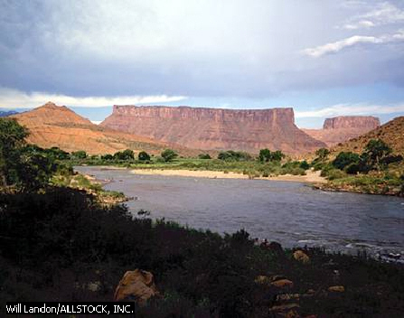
spectacular lowlands as well. The Colorado River, measuring 1450
miles in its entirety, has carved a number of deep canyons and gorges
along its path through the state.
Famous
for its portion of the Rocky Mountains, the state of Colorado has
spectacular lowlands as well. The Colorado River, measuring 1450
miles in its entirety, has carved a number of deep canyons and gorges
along its path through the state. 
PHYSICAL GEOGRAPHY
Colorado ranks eighth among the states in size. It has an area of 104,100 square miles, including 371 square miles of inland waters. The state is rectangular in shape, measuring 387 miles from east to west and 276 miles from north to south. Colorado straddles the Continental Divide, which separates rivers flowing to the Pacific Ocean and the Gulf of Mexico. In Colorado the lands west of the divide are referred to as the Western Slope, while those to the east are often called the Eastern Slope.

Natural Regions
Colorado includes parts of three major physical graphic areas of the western United States. They are, from east to west, the Great Plains, the Southern Rocky Mountains, and the Colorado Plateau. In addition, Colorado includes small sections of two other natural regions, the Wyoming, or Green River, Basin and the Rocky Mountains, which lie in the extreme northwest. Both of these regions are, like the Southern Rocky Mountains, part of the vast Rocky Mountain System.
The Great Plains,
a broad expanse of flat or rolling prairies that extend from Alberta
to Texas, cover the eastern third of Colorado. They rise gently from
about 4000 feet above sea level along the Kansas state line to about
7000 feet above sea level at the eastern foot of the Rocky Mountains.
The plains are used mainly for growing wheat and other crops and for
grazing cattle.
The physical features of the Great Plains are not uniform throughout the state. The plains are sometimes divided into three sections: the High Plains, the Colorado Piedmont, and the Raton section.
The High Plains, which include the most level land in the Great Plains, extend along the eastern border of Colorado. The only significant variations in relief occur where steep-sided river valleys, such as those of the Arkansas and Republican rivers, cross the plains or where there are shallow saucer like depressions.
The Colorado Piedmont, to the west of the High Plains, is more varied in relief, and many low ridges, steep bluffs, flat-topped mesas, and conical hills, called tepee buttes, rise above the surface. In the south the piedmont merges with the Raton section. The Raton section, more rugged than the Colorado Piedmont, includes numerous mesas and buttes of volcanic origin and narrow, rocky canyons.
 The
Southern Rocky Mountains occupy most of central Colorado
and extend in a north-south direction across the state. In Colorado
the Rockies are between 75 and 175 miles wide and include 53 peaks
that are more than 14,000 feet in elevation.
The
Southern Rocky Mountains occupy most of central Colorado
and extend in a north-south direction across the state. In Colorado
the Rockies are between 75 and 175 miles wide and include 53 peaks
that are more than 14,000 feet in elevation.
The mountains do not form a single highland area but are divided into two roughly parallel groups, or belts, of ranges. Several broad, high-altitude valleys and mountain basins separate the mountain belts from each other.
The eastern mountain belt
includes the Laramie Mountains, the Front Range, and part of the
Sangre de Cristo Mountains. The highest peaks of these eastern ranges
are Blanca Peak, 